Checked
Mississauga neighbourhoods: a guide to the main areas
Mississauga, Ontario, Canada
A factual guide to the main areas of Mississauga, Ontario: the City's Official Plan character areas grouped into five districts, with 2021 census population, age and housing, plus libraries, community centres, GO and Transitway stations, schools and major parks in each.
Key information
Mississauga is divided into 11 wards and, for planning, into 57 Official Plan character areas: a downtown, neighbourhoods such as Port Credit, Clarkson-Lorne Park, Cooksville, Erin Mills, Churchill Meadows, Meadowvale, Streetsville and Malton, and large employment areas around Pearson Airport. In the 2021 census East Credit was the most populous neighbourhood (63,320 people), and the four downtown areas were almost entirely apartment buildings of five or more storeys.
On this page
How is Mississauga divided into neighbourhoods?
- Downtown
Downtown Core, Fairview, Cooksville and Hospital: 72,900 people in 2021.
- Lakeshore south
Port Credit, Lakeview, Mineola, Clarkson-Lorne Park and Sheridan: 96,425 people.
- Central and east
Cooksville, Hurontario, Mississauga Valleys, Erindale, Rathwood and Applewood: 199,585 people.
- West and northwest
Erin Mills, Churchill Meadows, Lisgar, Meadowvale, Streetsville and East Credit: 273,805 people.
- North and airport
Malton, Meadowvale Village and the Pearson Airport employment lands: 69,160 people.
Mississauga uses two official ways to split the city. For elections, City Council has 11 wards, each with one councillor. For planning, the Mississauga Official Plan divides the city into character areas. The City also publishes 2021 census figures for the same areas, which makes them the most useful official neighbourhood boundaries.
The City's character area map layer has 57 areas: 25 neighbourhoods, 4 downtown areas, 3 major nodes, 9 community nodes, 4 corporate centres, 10 employment areas and 2 special purpose areas (Pearson Airport and the University of Toronto Mississauga). Community nodes and major nodes are smaller centres of shops, services and apartments inside the wider neighbourhoods, such as the community nodes in Port Credit, Streetsville, Clarkson Village, Meadowvale and Malton.
This guide groups the character areas into five districts so you can scan the city quickly: downtown, the Lakeshore south, central and east, west and northwest, and the north and airport area. The districts are an editorial grouping for this page, not City boundaries.
Sources: City Council members | City of Mississauga · Mississauga Official Plan | City of Mississauga · Mississauga Official Plan (2010) Character Area and City Structure map layer · 2021 Census Data by Neighbourhoods (City of Mississauga open data)
Population, age and housing in every Mississauga neighbourhood
- East Credit63,320 people
- Hurontario49,385 people
- Churchill Meadows48,750 people
- Erin Mills38,320 people
- Applewood36,015 people
- Meadowvale35,915 people
- Clarkson-Lorne Park35,885 people
- Malton35,250 people
- Downtown Core34,425 people
- Lisgar31,565 people
| Area | District | Type | Population 2021 | Median age | Single-detached | Apartments 5+ storeys | Other attached | Owned |
|---|---|---|---|---|---|---|---|---|
| Downtown Core | Downtown | Downtown | 34,425 | 34.4 | 0% | 98% | 2% | 52% |
| Downtown Fairview | Downtown | Downtown | 16,565 | 38.4 | 0% | 87% | 13% | 43% |
| Downtown Cooksville | Downtown | Downtown | 9,575 | 38 | 1% | 88% | 11% | 40% |
| Downtown Hospital | Downtown | Downtown | 12,335 | 37.2 | 1% | 91% | 7% | 10% |
| Port Credit (community node) | Lakeshore south | Community node | 4,945 | 49 | 1% | 85% | 14% | 28% |
| Port Credit (East) | Lakeshore south | Neighbourhood | 2,420 | 43.6 | 40% | 3% | 57% | 48% |
| Port Credit (West) | Lakeshore south | Neighbourhood | 3,080 | 42.8 | 26% | 25% | 49% | 55% |
| Lakeview | Lakeshore south | Neighbourhood | 21,960 | 44.8 | 52% | 31% | 17% | 72% |
| Mineola | Lakeshore south | Neighbourhood | 9,850 | 44.8 | 82% | 2% | 17% | 90% |
| Clarkson-Lorne Park | Lakeshore south | Neighbourhood | 35,885 | 42.8 | 55% | 8% | 38% | 80% |
| Clarkson Village (community node) | Lakeshore south | Community node | 2,810 | 52 | 1% | 76% | 23% | 66% |
| Sheridan | Lakeshore south | Neighbourhood | 12,210 | 45.2 | 68% | 10% | 22% | 82% |
| Sheridan (community node) | Lakeshore south | Community node | 3,265 | 31.6 | 0% | 83% | 17% | 20% |
| Cooksville (East) | Central and east | Neighbourhood | 8,420 | 43.6 | 53% | 21% | 26% | 74% |
| Cooksville (West) | Central and east | Neighbourhood | 14,640 | 44.8 | 32% | 18% | 50% | 72% |
| Hurontario | Central and east | Neighbourhood | 49,385 | 42 | 43% | 12% | 45% | 81% |
| Uptown (major node) | Central and east | Major node | 10,660 | 39 | 0% | 85% | 15% | 58% |
| Mississauga Valleys | Central and east | Neighbourhood | 12,595 | 43.2 | 24% | 23% | 53% | 79% |
| Fairview | Central and east | Neighbourhood | 7,215 | 46 | 65% | 0% | 35% | 85% |
| Erindale | Central and east | Neighbourhood | 22,035 | 42 | 34% | 18% | 48% | 71% |
| Creditview | Central and east | Neighbourhood | 10,070 | 44.4 | 77% | 5% | 19% | 83% |
| Rathwood | Central and east | Neighbourhood | 24,865 | 47.2 | 51% | 10% | 39% | 78% |
| Rathwood-Applewood (community node) | Central and east | Community node | 3,345 | 42.8 | 0% | 91% | 9% | 45% |
| Applewood | Central and east | Neighbourhood | 36,015 | 42.8 | 23% | 44% | 33% | 55% |
| Dixie employment area | Central and east | Employment area | 340 | 46.8 | 9% | 25% | 29% | 51% |
| Erin Mills | West and northwest | Neighbourhood | 38,320 | 44.4 | 53% | 7% | 40% | 86% |
| Central Erin Mills | West and northwest | Neighbourhood | 29,995 | 43.2 | 57% | 6% | 37% | 82% |
| Central Erin Mills (major node) | West and northwest | Major node | 6,295 | 36 | 0% | 81% | 19% | 44% |
| South Common (community node) | West and northwest | Community node | 4,885 | 40 | 0% | 73% | 27% | 31% |
| Churchill Meadows | West and northwest | Neighbourhood | 48,750 | 36 | 40% | 0% | 60% | 80% |
| Lisgar | West and northwest | Neighbourhood | 31,565 | 39.6 | 62% | 0% | 38% | 93% |
| Meadowvale | West and northwest | Neighbourhood | 35,915 | 40.8 | 43% | 13% | 44% | 80% |
| Meadowvale (community node) | West and northwest | Community node | 2,855 | 36 | 0% | 38% | 63% | 11% |
| Streetsville | West and northwest | Neighbourhood | 10,585 | 44 | 52% | 5% | 43% | 81% |
| Streetsville (community node) | West and northwest | Community node | 1,320 | 46.4 | 11% | 52% | 37% | 23% |
| East Credit | West and northwest | Neighbourhood | 63,320 | 40.4 | 57% | 5% | 38% | 83% |
| Malton | North and airport area | Neighbourhood | 35,250 | 34.4 | 24% | 9% | 67% | 64% |
| Malton (community node) | North and airport area | Community node | 2,670 | 32.8 | 0% | 29% | 70% | 10% |
| Meadowvale Village | North and airport area | Neighbourhood | 31,240 | 38 | 47% | 0% | 53% | 90% |
The table lists every character area with residents in the City's 2021 census tables, 39 in all, with a combined 711,875 people in private households. Employment areas, corporate centres, the airport and the university have no published population, and Dixie-Dundas has no separate census row. Figures come from the census 25% sample, so small areas round more.
Housing columns show the share of households in each building type. Other attached homes are semi-detached houses, row and townhouses, duplex apartments and apartments in buildings under five storeys.
Sources: 2021 Census Data by Neighbourhoods (City of Mississauga open data) · City planning data: Census | City of Mississauga · Mississauga Official Plan (2010) Character Area and City Structure map layer
Downtown Mississauga
| Area | Libraries and community centres | GO, Transitway and terminal | Schools | Destination parks |
|---|---|---|---|---|
| Downtown Core | Hazel McCallion Central Library | City Centre Transit Terminal | 1 | Community Common; Kariya Park; Living Arts Centre Grounds; Mississauga Celebration Square (North); Mississauga Celebration Square (South); Scholars' Green |
| Downtown Fairview | None recorded | None recorded | 1 | None recorded |
| Downtown Cooksville | Cooksville Library | Cooksville GO Station | 1 | Cooksville Four Corners |
| Downtown Hospital | None recorded | None recorded | 1 | None recorded |
Downtown Mississauga is centred on Hurontario Street and made up of four character areas: Downtown Core, Downtown Fairview, Downtown Cooksville and Downtown Hospital. Together they had 72,900 residents in 2021. In every downtown area at least 87% of households live in apartment buildings of five or more storeys, and Downtown Core is 98%. Downtown Hospital and the Malton community node had the highest renter shares in the city (about 90% of households).
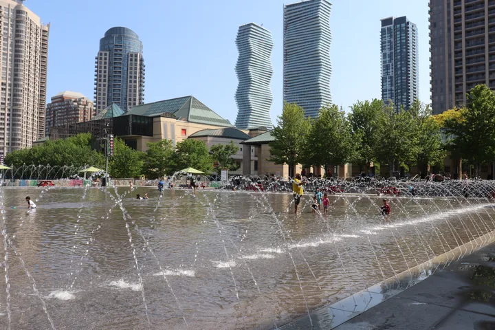
Downtown Core holds Mississauga Celebration Square (300 City Centre Drive), the Hazel McCallion Central Library (301 Burnhamthorpe Road West), the City Centre Transit Terminal (200 Rathburn Road West), Sheridan College's campus at 4180 Duke of York Boulevard, and parks such as Kariya Park, Scholars' Green and Community Common. Trillium Health Centre (100 Queensway West) is in Downtown Hospital, and Cooksville GO Station and Cooksville Library are in Downtown Cooksville.
The Hazel McCallion Line, an 18 km light rail line with 19 stops being built by Metrolinx along Hurontario Street from Port Credit GO to Brampton Gateway Terminal, will run through downtown. Metrolinx's project page gives no opening date.
Sources: 2021 Census Data by Neighbourhoods (City of Mississauga open data) · Mississauga Official Plan (2010) Character Area and City Structure map layer · Mississauga Find a park records (CITY_POI layer) · Hazel McCallion LRT | Metrolinx · Library locations | Mississauga Library
Lakeshore south: Port Credit, Lakeview, Mineola, Clarkson-Lorne Park and Sheridan
| Area | Libraries and community centres | GO, Transitway and terminal | Schools | Destination parks |
|---|---|---|---|---|
| Port Credit (community node) | Port Credit Library | Port Credit GO Station | 1 | J.J. Plaus Park; Marina Park; Port Credit Memorial Park; St. Lawrence Park |
| Port Credit (East) | None recorded | None recorded | 3 | None recorded |
| Port Credit (West) | None recorded | None recorded | 0 | Brueckner Rhododendron Gardens; J.C. Saddington Park |
| Lakeview | Carmen Corbasson Community Centre and Arena; Lakeview Library | None recorded | 8 | Adamson Estate; Douglas Kennedy Park; Lakefront Promenade; R.K. McMillan Park |
| Mineola | None recorded | None recorded | 6 | None recorded |
| Clarkson-Lorne Park | Clarkson Community Centre; Clarkson Library; Lorne Park Library | None recorded | 15 | Benares Museum Grounds; Bradley Museum Grounds; Clarkson Park; Jack Darling Memorial Park; Richard's Memorial Park |
| Sheridan | None recorded | None recorded | 5 | None recorded |
| Sheridan (community node) | Sheridan Library | None recorded | 0 | None recorded |
| Southdown employment area | None recorded | Clarkson GO Station | 0 | Harding Waterfront Estate; Lakeside Park |
| Clarkson employment area | None recorded | None recorded | 1 | None recorded |
The south of the city lines Lake Ontario and Lakeshore Road. Clarkson-Lorne Park is the largest area here (35,885 people in 2021), with 55% of households in single-detached houses. Mineola has the highest single-detached share of any Mississauga neighbourhood (82%). Lakeview mixes houses (52% single-detached) with apartment towers (31%).
Port Credit, on the Credit River at Lake Ontario, is split into a community node around Lakeshore Road and Hurontario Street plus east and west neighbourhoods. In the node, 85% of households live in apartment buildings and the median age is 49. Clarkson Village had the oldest median age of any area (52).
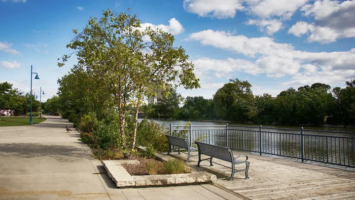
Port Credit GO and Clarkson GO stations are on the Lakeshore West line. Port Credit GO will also be the south end of the Hazel McCallion Line. Waterfront parks include Jack Darling Memorial Park, Lakeside Park, Lakefront Promenade, Port Credit Memorial Park and J.C. Saddington Park. Clarkson-Lorne Park is also home to the Bradley Museum and Benares Historic House.
Sources: 2021 Census Data by Neighbourhoods (City of Mississauga open data) · Mississauga Official Plan (2010) Character Area and City Structure map layer · Mississauga Find a park records (CITY_POI layer) · GO Transit Lakeshore West timetable (Table 1) · Hazel McCallion LRT | Metrolinx
Central and east: Cooksville, Hurontario, Mississauga Valleys, Erindale, Rathwood and Applewood
| Area | Libraries and community centres | GO, Transitway and terminal | Schools | Destination parks |
|---|---|---|---|---|
| Cooksville (East) | None recorded | None recorded | 6 | Hancock Woodlands |
| Cooksville (West) | None recorded | None recorded | 4 | Brickyard Park |
| Hurontario | Frank McKechnie Community Centre; Frank McKechnie Library | None recorded | 13 | Iceland Arena & Sports Park; McKechnie Woods |
| Mississauga Valleys | Mississauga Valley Community Centre; Mississauga Valley Library | None recorded | 5 | Mississauga Valley |
| Fairview | None recorded | None recorded | 5 | Dr. Martin L. Dobkin Community Park |
| Erindale | Huron Park Community Centre; Woodlands Library | None recorded | 11 | Erindale Park; Huron Park; Riverwood |
| Creditview | None recorded | Erindale GO Station | 2 | None recorded |
| Rathwood | None recorded | Transitway: Central Parkway Station | 7 | Garnetwood Park |
| Rathwood-Applewood (community node) | Burnhamthorpe Community Centre; Burnhamthorpe Library | None recorded | 0 | Ternopil Park |
| Applewood | None recorded | None recorded | 13 | None recorded |
| Dixie employment area | None recorded | Dixie GO Station | 0 | None recorded |
The middle and east of the city are mostly suburban neighbourhoods on either side of Hurontario Street. Hurontario (49,385 people) and Applewood (36,015) are the biggest. Applewood has many apartment towers: 44% of households live in buildings of five or more storeys and 45% rent. Rathwood had the oldest median age among the large neighbourhoods (47.2), and Creditview is mostly single-detached houses (77%).
Uptown is a major node where 85% of households live in apartment buildings of five or more storeys. Erindale includes Erindale Park, which the City calls its largest park, and the University of Toronto Mississauga sits in its own special purpose area on Mississauga Road.
Erindale GO (Milton line) is in Creditview, and Dixie GO is in the Dixie employment area. The Mississauga Transitway (bus rapid transit) has stations at Central Parkway in Rathwood and at Cawthra, Tomken and Dixie Roads along the northern edge of this district.
Sources: 2021 Census Data by Neighbourhoods (City of Mississauga open data) · Mississauga Official Plan (2010) Character Area and City Structure map layer · Mississauga Find a park records (CITY_POI layer) · GO Transit Milton line timetable (Table 21) · MiWay station locations | City of Mississauga · Erindale Park | City of Mississauga
West and northwest: Erin Mills, Churchill Meadows, Lisgar, Meadowvale, Streetsville and East Credit
| Area | Libraries and community centres | GO, Transitway and terminal | Schools | Destination parks |
|---|---|---|---|---|
| Erin Mills | None recorded | None recorded | 10 | Tom Chater Memorial Park |
| Central Erin Mills | None recorded | Transitway: Erin Mills Station | 9 | Quenippenon Meadows |
| Central Erin Mills (major node) | Erin Meadows Community Centre; Erin Meadows Library | None recorded | 1 | None recorded |
| South Common (community node) | None recorded | None recorded | 1 | South Common |
| Churchill Meadows | Churchill Meadows Library | Transitway: Winston Churchill Station | 12 | None recorded |
| Ninth Line | Churchill Meadows Community Centre | None recorded | 0 | Mattamy Sports Park |
| Lisgar | None recorded | None recorded | 9 | None recorded |
| Meadowvale | None recorded | None recorded | 13 | Lake Aquitaine Park |
| Meadowvale (community node) | Meadowvale Community Centre; Meadowvale Library | None recorded | 0 | None recorded |
| Streetsville | None recorded | Streetsville GO Station | 5 | Streetsville Memorial Park |
| Streetsville (community node) | Streetsville Library | None recorded | 0 | Streetsville Village Square |
| East Credit | River Grove Community Centre | None recorded | 15 | River Grove |
| Meadowvale Business Park corporate centre | None recorded | Lisgar GO Station; Meadowvale GO Station | 2 | Meadowvale Sports Park; Totoredaca Park |
| Western Business Park employment area | None recorded | None recorded | 1 | Ninth Line Sports Park |
The west is the most populous part of the city. East Credit was the largest neighbourhood in Mississauga in 2021 (63,320 people), followed by Churchill Meadows (48,750) and Erin Mills (38,320). These areas are mostly houses and townhouses: Lisgar had the highest home ownership of any area (93%), and Churchill Meadows had a median age of 36 with 60% of households in semi-detached, town and other attached homes.
Streetsville's community node centres on Queen Street South, where Streetsville Library (112 Queen Street South) and Streetsville Village Square are. Meadowvale includes Lake Aquitaine Park. Central Erin Mills includes Credit Valley Hospital (2200 Eglinton Avenue West) and a major node where 81% of households live in apartment buildings.
Streetsville, Meadowvale and Lisgar GO stations are on the Milton line. The Transitway has Erin Mills and Winston Churchill stations. Mattamy Sports Park and Churchill Meadows Community Centre are in the Ninth Line area, which had no published population in the 2021 census. South Common Community Centre and Library are closed for renovation until summer 2027.
Sources: 2021 Census Data by Neighbourhoods (City of Mississauga open data) · Mississauga Official Plan (2010) Character Area and City Structure map layer · Mississauga Find a park records (CITY_POI layer) · GO Transit Milton line timetable (Table 21) · MiWay station locations | City of Mississauga · Recreation locations | City of Mississauga
North and airport area: Malton, Meadowvale Village and Pearson
| Area | Libraries and community centres | GO, Transitway and terminal | Schools | Destination parks |
|---|---|---|---|---|
| Malton | None recorded | None recorded | 13 | None recorded |
| Malton (community node) | Malton Community Centre; Malton Library | None recorded | 0 | Elmcreek Park |
| Meadowvale Village | Courtneypark Library | None recorded | 10 | Courtneypark Athletic Fields |
| Airport corporate centre | None recorded | Transitway: Etobicoke Creek Station; Transitway: Orbitor Drive Station; Transitway: Renforth Drive Station; Transitway: Spectrum Way Station; Transitway: Tahoe Boulevard Station | 0 | None recorded |
| Gateway corporate centre | None recorded | None recorded | 1 | None recorded |
| Gateway employment area (East) | None recorded | None recorded | 0 | Dunton Athletic Fields; Max Ward Memorial Park; Mississauga Sports And Entertainment Centre |
| Gateway employment area (West) | None recorded | None recorded | 0 | Saigon Park |
| Northeast employment area (East) | None recorded | Malton GO Station | 0 | Paul Coffey Park |
| Northeast employment area (West) | None recorded | Transitway: Cawthra Road Station; Transitway: Dixie Road Station; Transitway: Tomken Road Station | 1 | None recorded |
Malton, in the northeast corner of the city beside the airport lands, had 37,920 residents in 2021 across its neighbourhood and community node. It had one of the youngest populations (median age 34.4), and 76% of households lived in apartments or attached homes. Malton GO Station is on the Kitchener line, and Malton Community Centre and Library share 3540 Morning Star Drive.
Meadowvale Village, in the north-centre of the city, is mostly houses and townhouses (31,240 people, 90% owners). Courtneypark Library is here.
Most of the rest of the north is the airport and its employment and corporate areas (Airport, Gateway and Northeast), with no published population. Transitway stations at Renforth, Spectrum, Orbitor, Tahoe and Etobicoke Creek serve the Airport Corporate Centre. Paul Coffey Park and Max Ward Memorial Park, with its airplane viewing platform and toboggan hill, are in this district.
Sources: 2021 Census Data by Neighbourhoods (City of Mississauga open data) · Mississauga Official Plan (2010) Character Area and City Structure map layer · Mississauga Find a park records (CITY_POI layer) · GO Transit Kitchener line timetable (Table 31) · MiWay station locations | City of Mississauga · Paul Coffey Park | City of Mississauga · Max Ward Memorial Park | City of Mississauga
GO stations and rapid transit by area
| GO station | Line | Address | Area |
|---|---|---|---|
| Clarkson GO Station | Lakeshore West | 1110 Southdown Rd | Southdown employment area |
| Cooksville GO Station | Milton | 3210 Hurontario St | Downtown Cooksville |
| Dixie GO Station | Milton | 2445 Dixie Rd | Dixie employment area |
| Erindale GO Station | Milton | 1320 Rathburn Rd W | Creditview |
| Lisgar GO Station | Milton | 3250 Argentia Rd | Meadowvale Business Park corporate centre |
| Malton GO Station | Kitchener | 3060 Derry Rd E | Northeast employment area (East) |
| Meadowvale GO Station | Milton | 6845 Millcreek Dr | Meadowvale Business Park corporate centre |
| Port Credit GO Station | Lakeshore West | 30 Queen St E | Port Credit (community node) |
| Streetsville GO Station | Milton | 45 Thomas St | Streetsville |
Mississauga has nine GO train stations on three lines and a Transitway for buses across the middle of the city. MiWay buses connect every area. Areas within about 500 to 800 metres of a major transit stop are called major transit station areas, and the City says it has more than 60.
Sources: GO Transit Milton line timetable (Table 21) · GO Transit Lakeshore West timetable (Table 1) · GO Transit Kitchener line timetable (Table 31) · Mississauga Find a park records (CITY_POI layer) · Major transit station areas | City of Mississauga · MiWay station locations | City of Mississauga
Big parks in each area
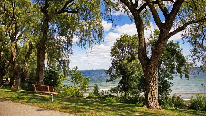
The City classes its largest parks as destination parks. Every area table above lists the destination parks inside it. A few examples: Jack Darling Memorial Park and Lakeside Park on the lake; Erindale Park on the Credit River; Lake Aquitaine Park in Meadowvale; Streetsville Memorial Park; Mississauga Valley Park; and Paul Coffey Park in Malton. For every park, including playgrounds, spray pads and sports fields, use the parks directory.
Sources: Find a park | City of Mississauga · Mississauga Find a park records (CITY_POI layer)
Schools in Mississauga neighbourhoods
The City's map layer records 212 school buildings: 101 public elementary, 67 Catholic elementary, 19 public secondary, 16 Catholic secondary, 6 French-language and 3 private. Each area table shows how many fall in each area.
Public schools are run by the Peel District School Board and Catholic schools by the Dufferin-Peel Catholic District School Board. Your home school depends on your address, so use the board's school locator before you choose a home. This guide does not rank schools.
Sources: Mississauga Find a park records (CITY_POI layer) · Peel District School Board: Register for school · Dufferin-Peel Catholic District School Board
Questions about Mississauga neighbourhoods
How many wards does Mississauga have?
Eleven. Each ward elects one councillor to City Council.
What are character areas in Mississauga?
They are the planning areas in the Mississauga Official Plan, such as neighbourhoods, downtown areas, community nodes and employment areas. The City map layer has 57 of them.
Source: Mississauga Official Plan (2010) Character Area and City Structure map layer
Which Mississauga neighbourhood has the most people?
East Credit, with 63,320 people in private households in the 2021 census, followed by Hurontario (49,385) and Churchill Meadows (48,750).
Source: 2021 Census Data by Neighbourhoods (City of Mississauga open data)
Where are most of the condos and apartment towers in Mississauga?
Downtown. In Downtown Core 98% of households lived in buildings of five or more storeys in 2021. Uptown, Applewood, Port Credit and Central Erin Mills also have many apartments.
Source: 2021 Census Data by Neighbourhoods (City of Mississauga open data)
Which Mississauga neighbourhoods are mostly detached houses?
Mineola (82% single-detached), Creditview (77%), Sheridan (68%) and Fairview (65%) in 2021.
Source: 2021 Census Data by Neighbourhoods (City of Mississauga open data)
Which areas of Mississauga have a GO station?
Port Credit and Clarkson (Lakeshore West line); Dixie, Cooksville, Erindale, Streetsville, Meadowvale and Lisgar (Milton line); and Malton (Kitchener line).
Where will the Hazel McCallion Line LRT run?
Along Hurontario Street from Port Credit GO through downtown Mississauga to Brampton Gateway Terminal, 18 km with 19 stops. Metrolinx has not published an opening date on its project page.
Source: Hazel McCallion LRT | Metrolinx
Which Mississauga neighbourhood has the youngest population?
Among larger neighbourhoods, Malton and Downtown Core both had a median age of 34.4 in 2021. The small Sheridan community node was 31.6.
Source: 2021 Census Data by Neighbourhoods (City of Mississauga open data)
Where can I find census data for my Mississauga neighbourhood?
The City publishes 2021 census tables by neighbourhood and by ward on its open data site and City Planning Data Hub.
How do I find my school in a Mississauga neighbourhood?
Use the Peel District School Board or Dufferin-Peel Catholic District School Board school locator with your address. Home schools are set by address.